


Col de Collebasse

i20
User
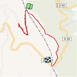

Length
1.9 km

Max alt
182 m

Uphill gradient
43 m
Km-Effort
2.6 km

Min alt
134 m

Downhill gradient
77 m
Boucle
No
Creation date :
2014-12-10 00:00:00.0
Updated on :
2014-12-10 00:00:00.0
--
Difficulty : Very easy

FREE GPS app for hiking
 SityTrail
IGN / Geographical institutes
SityTrail Plus
The world is yours!
About
Trail Walking of 1.9 km to be discovered at Provence-Alpes-Côte d'Azur, Var, La Croix-Valmer. This trail is proposed by i20.
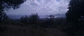
Photos


Positioning
Country:
France
Region :
Provence-Alpes-Côte d'Azur
Department/Province :
Var
Municipality :
La Croix-Valmer
Location:
Unknown
Start:(Dec)
Start:(UTM)
305401 ; 4785937 (32T) N.
Comments